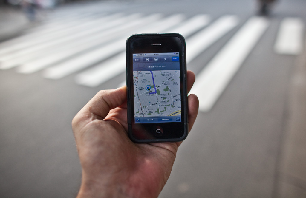
Remember when using a map application on a mobile phone was a lesson in frustration and humility? Underperforming hardware, through-a-straw data connection and a choice between battery life and all that it offers or the novelty of a GPS connection. Fast forward a couple of years to the present and the smartphone world is just about moving out of Location 1.0, which with the risk of gross oversimplification can be condensed to: figuring out where you want to go and why, and how to get there, exploration-lite of the world around you, all in a sufficiently usable experience.
Early adopters (in the global sense of the word) are now feeling out Location 2:0: with the promise of meaningful information feeds on tap – your transport options in the near and now, seats at a recommended restaurant, awareness of friends, casual sex on-demand, well gardened user generated content; meaningful use of historical and near-time data – heat maps will move from ‘pretty’ to ‘pretty useful’; all integrated into your social graph. The technology has also evolved: AGPS, DGPS and beyond enabling faster, accuracy and a more consistent experience. As the best practice is disseminated, user practice and user literacy are starting to settle the technology is moving from foreground to background.
It’s all tickety boo.
Or is it?
If you use the Google Maps app in China (photo above) you’ll see the location degraded by up to a couple of hundred meters rendering it too painful for everyday use. Degrading location signals are nothing new – the policy of Selective Availability meant that until May 1st 2000 GPS signals were only accurate for civilian users to 300 meters (it is now closer to 5 meters horizontally, in clear conditions). Local powerhaus Baidu is well established in this space – foreign companies are currently barred from offering map services, though it now looks like this will soon change.
By now we can all see far enough ahead to appreciate that an ambient or fine grained location awareness of the stuff that’s important to us and for us will be as technologically feasible and socially acceptable as the move from tethered to mobile phones.
In world where we take ‘location’ for granted, who is motivated, in what contexts to either degrade or starve us of our location feed, or to falsify the feed and literally send us in the wrong direction? My hunch is that over time the answers to these questions will take on a surprising shift: whilst the intelligence and heavy lifting will increasingly occur in the network, we’re going to see ‘smarterphones’ use caching and pre-caching* to store more information locally. The payment you made to the taxi driver through your phone – the digital receipt includes your route and destination. The vector graphic and streetview of the places you’ve visited, are likely to visit; the faces and last known location of your geo-aware social network within 3 degrees of separation – it will be feasible, and in most (though definitely not all) instances desirable to carry all of this in your pocket. (Those of you who’ve worked in environments where the connectivity can’t be taken for granted are probably smiling at this point – the need to think ahead to what network resources might be needed is engrained many of the design solutions for this space). There’s is another trajectory worth considering: location will be so tightly integrated within the fabric of all the services that we use that the only way to truly cut off ‘location’ will be to cut off connectivity to the services.
The network will definitely be useful, but it won’t always be critical.
Want to accurate know your location in China? Re-set your off-set map using a tool such as GPS Log LITE.
Related links: Tom Coates and the work of the Yahoo Geo team, nterview with Tomhere, and the Google Lat Long Blog.
* Pre-caching: locally storing what the user is likely to need by looking 2 or more degrees ahead, based on patterns of behaviour, upcoming event, what other’s in the social network have cached and so on. Assumes large local storage space, and decent bandwidth and access to power source whilst the data is being transferred.

3 Trackbacks
[…] This post was mentioned on Twitter by Jan Chipchase, raina kumra. raina kumra said: RT @janchip: Thoughts on the future of location awareness, via China: Having The Intelligence to Outsmart the Network: http://bit.ly/fp_lo […]
[…] This post was mentioned on Twitter by Michael Surtees, Future Perfect. Future Perfect said: New on FP: Having the Intelligence to Outsmart the Network: Remember when using a map application on a mobile pho… http://bit.ly/9v85vy […]
[…] Or more provocatively if the consumption based planning leads to a hierarchy of service wherein whole neighborhoods are left neglected (in this case with poor service, coverage/speeds) like holes “in swiss cheese“, can one imagine positive intervening typologies which harness this dead zone. As zones of contemplation, informal anarchy or minimally digital quiet. With growing fears about the longevity of digital memory and privacy could such holes in the cellular network/fabric serve as an anti-body, the next Iceland or Wild West where pasts are forgotten. Perhaps, this would be one way of as Jan Chipcase writes outsmarting the network. […]